A blistering heat wave obliterated high temperature records in Oregon and Washington over the weekend, ratcheting up risks for deaths and fires, and underscoring the dangers of climate change.
Portland, Oregon’s biggest city, hit a sweltering all-time high of 112 degrees Fahrenheit yesterday at its international airport, the National Weather Service said. That broke a record of 108 F set just a day earlier. Both days topped the previous record of 107 F, reached in 1981 and 1965.
The temperature in Salem, Oregon’s capital, soared to 113 F yesterday, smashing a record of 108 F hit in 1941 and 1927.
On supporting science journalism
If you're enjoying this article, consider supporting our award-winning journalism by subscribing. By purchasing a subscription you are helping to ensure the future of impactful stories about the discoveries and ideas shaping our world today.
The heat is expected to worsen today, with a jaw-dropping high of 115 F forecast for Portland, said Colby Neuman, a meteorologist in NWS’s Portland office.
“I have not seen very many events where places are breaking their all-time record high temperatures by 4 degrees, or 5 degrees,” said Neuman, who has been at NWS since 2008. “It’s one thing to break it by a degree or two, but it’s another thing to literally break it by 4 or 5 degrees, in places that have 100 years’ worth of data, or 120 years’ worth of data. That is pretty remarkable.”
Farther north, the Seattle-Tacoma International Airport hit 104 F yesterday a new all-time high that edged out the area’s previous record of 103 F, set in 2009.
Even beaches baked. Hoquiam, Wash., on the state’s west coast, reached 102 F. That shattered the previous record of 95 F set in 2016.
The forecast for today projects Seattle, Washington’s biggest and most populous city, will hit 110 F.
“We’ve never seen anything like this before," said Dustin Guy, a meteorologist with NWS’s office in Seattle. “We’ve only had three days of 100 or more degrees in 126 years, and it looks like we’re ready to get three of them in a row now. There’s really nothing to compare it to. We’ve never in anybody’s lifetimes seen anything quite like this before in Seattle."
The sweltering weather, expected to cool slightly tomorrow, appears to be part of a broader climate change trend. The Pacific Northwest’s average temperature has warmed more than 2 F compared with a century ago, with most of that change in the last 40 years. In addition, the number of extreme heat days has doubled in less than a century, and it likely won’t stop at that, said Larry O’Neill, Oregon’s state climatologist.
In 1940, he said, Portland had only about 10 days per year when the daily high temperature topped 90 F.
“By 2020, that number is at about 20 days per year,” O’Neill said. In Multnomah County, where Portland sits, “the projected change, by the middle of the century ... is an additional 20 days (per year) with temperatures above 90 degrees,” he said.
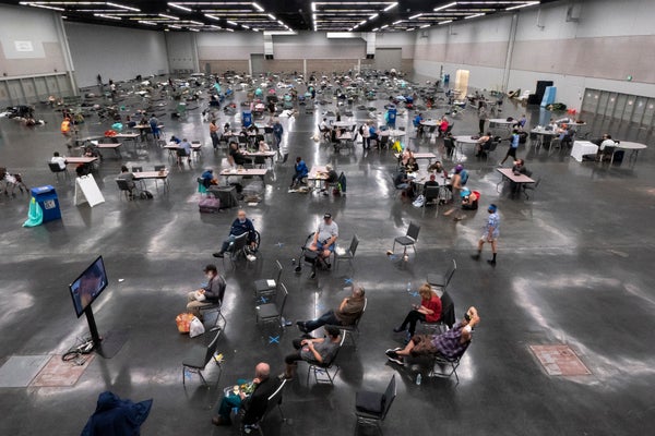
Those highs might not seem extreme compared with those in places where summer days typically exceed 90 F, often accompanied by high humidity. But Pacific Northwest residents are used to temperate weather, and many houses lack air conditioning, several weather experts said. That makes the heat wave potentially deadly.
“People in the Northwest, you know there’s a lot of vulnerability to it because ... it’s just kind of outside our normal operating range,” O’Neill said. “People will get exhaustion or heatstroke,” he added, and they may be unfamiliar with those symptoms. “So they’ll get sick and not know why.”
“Our health care system, also, is not necessarily designed to deal with large numbers of people who get heatstroke,” he added, “or get sick or have underlying health conditions that become exacerbated by this.”
The roasting of the Pacific Northwest follows other June heat waves in the West. Between June 10 and June 15, high temperatures set records in parts of California, Arizona, New Mexico, Utah, Colorado, Wyoming and Montana, Tom Di Liberto, in NOAA’s Climate Program Office, wrote in a post on NOAA’s website.
“It’s always difficult to immediately quantify how much impact climate change has had on a climate extreme, but there is plenty of evidence to show that high temperatures and heat waves have become worse due to climate change,” he wrote. “Heatwaves across the contiguous United States have occurred more often and lasted longer since the 1960s, which is consistent with a warming climate due to climate change.”
Record warm overnight lows set
The issue isn’t just with record high temperatures. During the heat wave, the Pacific Northwest hasn’t cooled down much at night—a dangerous situation. When that happens, opening windows doesn’t help homes cool off much, heat experts said. And people’s bodies don’t get a chance to cool off and recover.
“This is life-threatening heat,” Dr. Jennifer Vines, Multnomah County’s health officer, said in a post on the county’s website. “People need to find someplace cool to spend time during the coming days. And for people who already have somewhere cool, their job is to reach out to other people.”
The overnight low at Portland International Airport landed at 73 F yesterday morning. That broke the previous record “warm low” of 71 F, set in 2015.
Temperatures fell to a low of 73 F at Seattle-Tacoma International Airport early yesterday. That broke the previous “high low” of 71 F set in 2009.
That new record might get blown out today, based on the forecast for the low temperature today.
“We’re expecting lows of around ... 75 on Monday morning, so we’re probably going to be looking at possible record high minimums of all time,” said Guy, meteorologist at NWS Seattle.
The high temperatures came as the result of a high-pressure system over Oregon and Washington. Climate change played a role in that system, said O’Neill, Oregon’s state climatologist.
One of the mechanisms for the formation of a high-pressure system is tropical cyclone activity in the western Pacific Ocean, he said. Those are the West Coast equivalent of hurricanes. And like hurricanes, they are strengthened by warmer ocean temperatures.
High-pressure systems like the one driving the Pacific Northwest heat wave is “something like three times more likely to occur when we have a tropical cyclone out in the Pacific,” he said. “So climate change is impacting tropical cyclone activity through modulation of sea surface temperatures, and also things like wind shear.”
Fire risk heightened
The heat wave was expected to raise fire risk as it dries out vegetation, said Jim Critchley, fire chief of the Pendleton Fire Department in Umatilla County, about 200 miles east of Portland.
“It could be so dry that sparks from your car, from your catalytic converter, from a tow chain, from any of these things, mowing your yard or fields can set up a spark that can then ignite all of the fuels that we have,” Critchley said.
He sent teams who drove around the area asking residents to clear at least 30 feet away from buildings to “give the firefighters a chance to save the property or people, if we have that space that we can protect,” Critchley said.
The fact that this heat wave is hitting in June means the rest of summer could be a challenge, he said. Critchley noted that July 4 comes this weekend, and “everybody loves their Fourth of July fireworks. Everybody but fire chiefs.”
Utility officials in both states said they weren’t immediately planning any intentional electricity shut-offs to lower risk of fire ignitions, a technique that started in California and now is used in multiple Western states including Oregon and Nevada.
Portland General Electric “does not have plans to call a Public Safety Power Shutoff over the next few days,” Brittany Gonzalez, a spokesperson with the utility, said in an email. “If extreme weather conditions threaten our ability to safely operate the electrical grid, we will turn off power to help protect public safety.”
The utility first used an intentional power shut-off in September 2020, during wildfires in Oregon and California. It affected about 5,000 customers located near Mount Hood.
Utility spokespeople in both states said they were prepared for additional electricity demand. Andrew Padula, a spokesperson with Puget Sound Energy in Washington, said in an email that “we plan to meet all demand with PSE-owned generation assets. We have an additional 200 MW in reserve, which is 100 MW (more) than usual.”
Reprinted from E&E News with permission from POLITICO, LLC. Copyright 2021. E&E News provides essential news for energy and environment professionals.